Age verification
Are you 18 years of age or older?
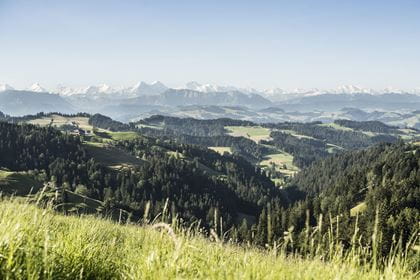
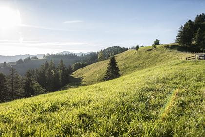
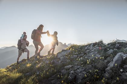
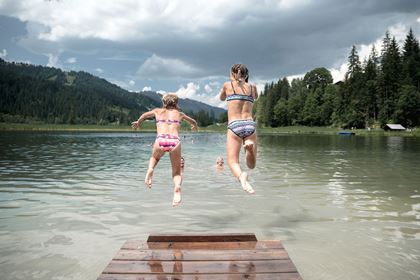
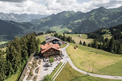
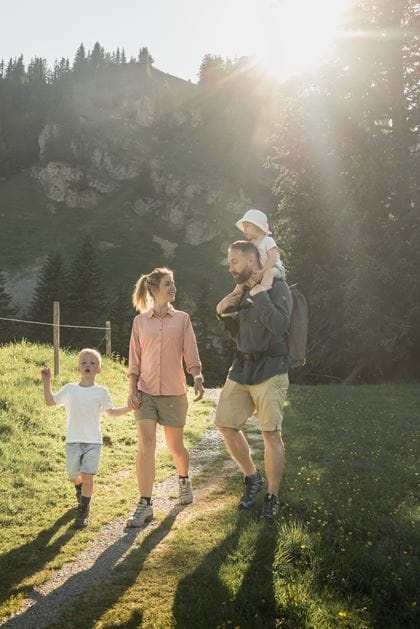
Gstaad hiking paradise
Discover the most beautiful hikes in the Gstaad region
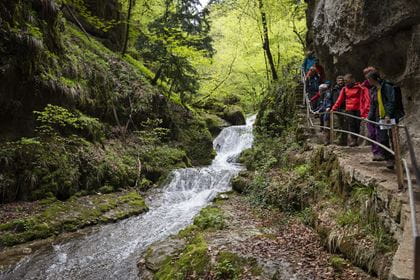
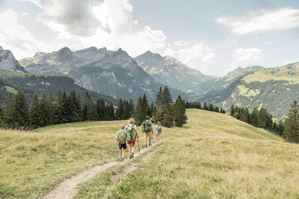
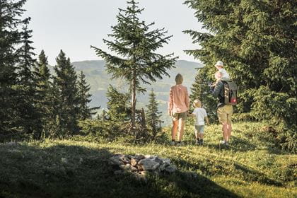
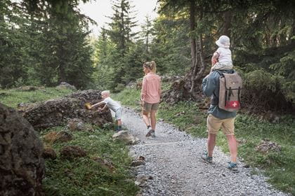
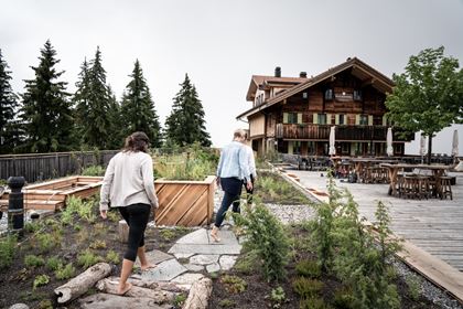
The hiking trails in the Gstaad holiday region lead through highly varied landscapes and give walkers the opportunity to explore moorland, deep ravines, Alpine valleys, lofty mountain peaks and, of course, the beautifully situated mountain inns along the way. Thanks to the cable cars and public transport, the trail network is highly accessible and offers the right route for every walker.
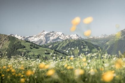
The hiking network around Gstaad is over 300 kilometers long. We have put together some route suggestions for you:
Rinderberg–Lengebrand–Ried (St. Stephan)

You can ride the gondola to get from Zweisimmen to the Rinderberg. The first section through avalanche barriers is steep, so you’ll need good footwear. It will take you around two hours to descend via Lengebrand to Ried (St. Stephan), with the route alternating between lush alpine meadows and shady wooded sections. Along the way, you can enjoy the magnificent views down into the Simmental valley. From Ried, you can take the train back to Zweisimmen.
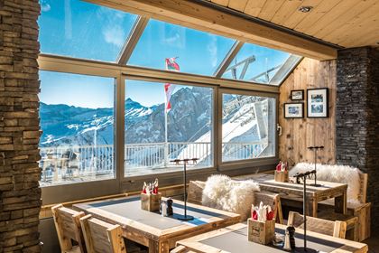
In Lengebrand, the famous Chemistube is the perfect spot to enjoy a tasty break.
Key figures
| Level of difficulty | easy |
| Length | 5.6 km |
| Elevation difference | 1038 m |
| Duration | 2 hours |
| Start | Rinderberg mountain station |
| End | Ried (St. Stephan) |
- Timetable & tickets By train to Zweisimmen (Rinderberg valley station)
- Gondola lift Zweisimmen–Rinderberg
- Operating data of the Gstaad cable cars
Rinderberg–Horneggli panorama trail
This easy high-altitude hike offers stunning views of the Bernese Alps and is perfect for anyone who wants to enjoy a scenic mountain experience with minimal elevation gain. Along the way, you’ll pass by two restaurants, the Hornberg and the Hornfluh. There is a children's playground near the mountain chalets.
Key figures
| Level of difficulty | easy |
| Walking time | approx. 2 hours |
| Ascent | 77 m |
| Descent | 310 m |
- Timetable & tickets By train to Zweisimmen (Rinderberg valley station)
- Mountain railway Rinderberg–Horneggli
- Operating data of the Gstaad cable cars
Alpine Magic Trail
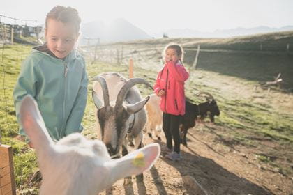
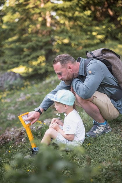
A journey through the magical world of the alpine pastures. Along the way, Saani, Giselle and Olga tell us exciting and interesting facts about alpine life at 8 stations. At the destination on the Rinderberg, you can romp around outside on the large facade playground or inside on Olga's cowshed playground. Afterwards, you can take the gondola down to the valley and listen to the Saani radio play «Fritz – The Hero».
The trail can also be followed from Rinderberg to Horneggli.
Giselle the chicken discovers the magical world of the Alps around the Hornberg and the Rinderberg with her friends Saani and Olga. Accompany them on their discovery tour. First, buy the Alpenzauber booklet at the valley station of the Horneggli chairlift. The chairlift then takes us comfortably from Schönried to Horneggli, the starting point of the hike. The chairlift runs five minutes from the railway station. Ideal for travellers arriving by train.
Once you are on the Horneggli, take the well-marked path toward Hornberg – Rinderberg. The Hornberg is the start of the Alpine Magic Trail. On the way, 8 stations shorten the time to the Rinderberg. The stations tell us exciting and interesting facts about alpine life. An alpine path leads from Hornberg to Parwengen. From there, the ascent to the Rinderberg begins. It is a gentle ascent on a good hiking trail with an incredible view of the main Alpine ridge.
From Rinderberg Spitz, at 2079 metres, it's just a short descent to the Rinderberg mountain restaurant at 2000 metres. There you can romp around outside on the large façade playground or inside in Olga's cowshed or relax on the sun terrace. The gondola then takes hikers back to Zweisimmen. Adventurers can hire a scooter for the rest of the descent at the middle station.
The trail can also be followed from Rinderberg to Horneggli. The Rinderberg valley station is also only 5 minutes away from Zweisimmen railway station and sells the Alpenzauber booklets too.
Key figures
| Level of difficulty | easy |
| Walking time | 2 hours 30 minutes |
| Length | 5.8 km |
| Ascent | 311 m |
| Descent | 70 m |
- Timetable & tickets By train to Zweisimmen (Rinderberg valley station)
- Mountain railway Zweisimmen–Rinderberg
- Operating data of the Gstaad cable cars
Wispile cheese trail
The Wispile Cheese Trail combines scenic hiking with insights into traditional alpine farming. Along the trail, various stations provide interesting facts about cheese-making and life on the alp. Beautiful views, rest areas, and mountain restaurants invite you to take enjoyable breaks along the way.
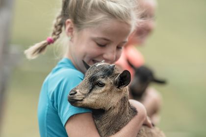
The trail also offers a variety of experiences for families: at the Wispile Mountain Lodge, a petting zoo and a playground provide additional entertainment.
Key figures
| Level of difficulty |
very easy |
| Walking time | approx. 45 minutes |
| Length | 1.9 km |
| Descent | 328 m |
Wispile–Lake Lauenen

Using the gondola, you can travel in comfort to the Berghaus Wispile restaurant (1907 m), where the hike begins. Keep following the mountain ridge and enjoy the panoramic view over the Saanenland region. At Chrinetritt, the path drops steeply to the Chrinepass (1659 m). Once there, you immediately ascend around 100 metres again. This takes you to the path heading towards the Lauenensee (1381 m). On the sloping mountain path, you’ll reach the nature reserve of the Lauenensee lakes.
Key figures
| Level of difficulty | medium |
| Length | 9.53 km |
| Duration | 3 hours |
| Start | Berghaus Wispile |
| End | Lake Lauenen |
Flower trail (Horneggli–Hornberg–Horneggli)
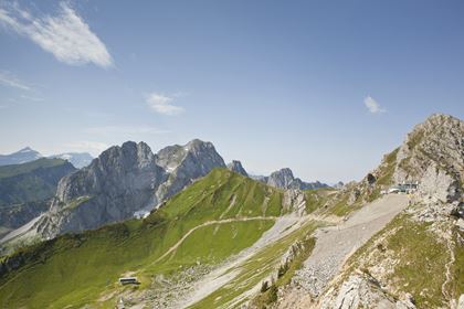
The chair lift takes you comfortably from Schönried to the Horneggli, the starting point for this hike. The Flower Trail is circular route that is mostly easy to hike and takes you around the Hornfluh. Green spleenwort is just one of many curious names hikers encounter along the trail, which offers an impression of everything that can flourish at an altitude of 1800 metres above sea level. Anyone who is less interested in the diversity of the flowers can enjoy the magnificent view of the green Saanenland and the untouched Turbachtal valley. The Gastlosen range can be seen to the north and the Wildstrubel and Wildhorn glacier mountains to the south. The best time of year is from late June to mid-September.
Key figures
| Level of difficulty | very easy |
| Duration | 1 hour |
| Lenght | 2.7 km |
| Ascent/Descent | +/- 101 m |
- Timetable & tickets By train to Schönried
- Chairlift Schönried–Horneggli
- Operating data of the Gstaad cable cars
La Videmanette circular walk
In Rougemont, take the gondola cableway up to La Videmanette. From the mountain station, you can enjoy the wonderful and far-reaching views of Rougemont and all the way to Pays d’Enhaut. In the opposite direction you can see the Bernese Alps, from the Wetterhorn to the Oldenhorn. The hike begins almost flat for the first 800 meters, then begins the steep descent towards Les Prax and later the ascent back to the mountain station. Some or all of this route follows mountain walking trails. Sturdy mountain shoes are recommended. After your walk, treat yourself to a good meal at the mountain restaurant and enjoy the fantastic and far-reaching views of the Bernese and Vaud Alps.
Key figures
| Level of difficulty | medium |
| Length | 6,6 km |
| Duration | 2 hours 30 minutes |
| Start | La Videmanette |
| End | La Videmanette |
| Ascent/Descent | +/- 430 m |
- Timetable & tickets By train to Rougement
- Gondola lift Rougement–La Videmanette
- Operating data of the Gstaad cable cars
Mountain railway operating hours Today (Friday) open
Please note the operating times of the respective mountain railway -> See hikes
BLS suggestion
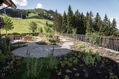
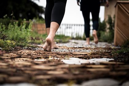
Alpine Herbs Trail by Swiss Alpine Herbs
Right next to the middle station of the Rinderberg gondola, you’ll find fragrant herbs, colourful blossoms and rippling water: The Alpine Herbs Trail by Swiss Alpine Herbs appeals to all the senses.


Location
Contact
- Ferienregion Gstaad
- +41 33 748 81 81
- Gstaad Saanenland Tourismus www.gstaad.ch