Age verification
Are you 18 years of age or older?
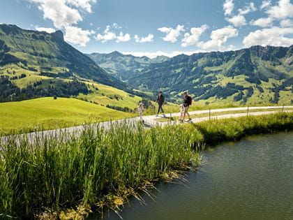
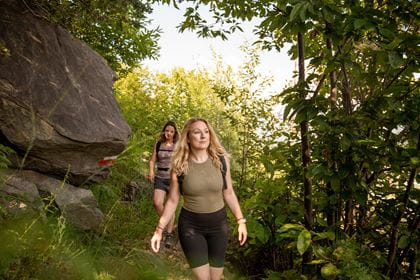
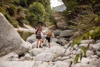
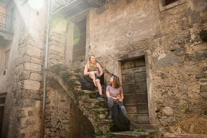
ViaStockalper Val Divedro hike
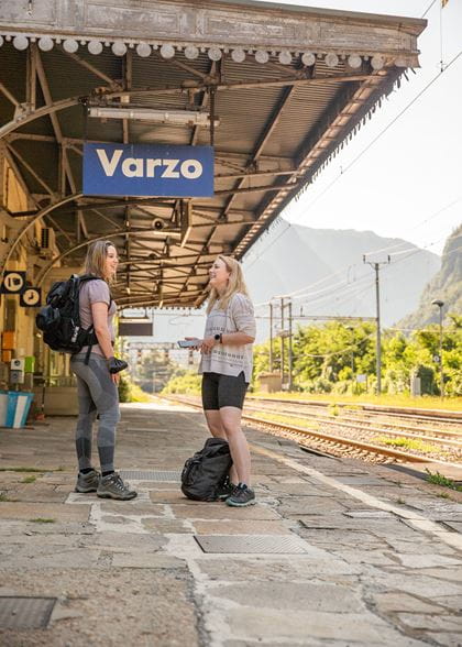
From Iselle di Trasquera to Varzo and Domodossola
The ViaStockalper Val Divedro hike from Iselle via Trasquera to Varzo and Domodossola is an insider’s tip in a charming Southern Alpine setting. This attractive yet challenging hike through the Val Divedro, along which the railway also runs, has been restored thanks to the Interreg TVA project.
This hike with all its Italian flair can be completed in full-day and part-day stages from the train stations of Iselle di Trasquera, Varzo, Preglia and Domodossola. The RegioExpress takes you comfortably from Bern to the starting point of your hike.
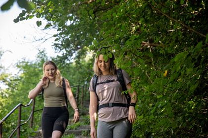
Hiking trail description
Iselle di Trasquera–Varzo section
- 3 hours Hiking time
- 8 km Distance
- T2 (mountain hiking) Degree of difficulty
- red-white marking Route signage
From Iselle di Trasquera train station, you head north briefly on Simplonstrasse. To the right, over the entrance to the Simplon tunnel, the path climbs steeply with steps, and gradually you see Iselle train station disappearing below you. Through Pianezza, you reach Chiezzo in the shade of the forest along historic mule tracks, passing a pretty hamlet on the lower part of the sunny terrace of Trasquera with a magnificent panorama and blissful alpine pastures. The trail climbs a little further to Trasquera, with a total of about 460 metres elevation gain to tackle. As you exit the village in the direction of Varzo, the church and the cemetery are enthroned by a wonderful view of Varzo and the entire Val Divedro.
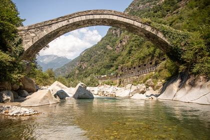
The descent winds in serpentines on the historic stone slab road “Via del Brocc” through the forest, down to Varzo. Before the road was built in 1961, this was the only route from Varzo to Trasquera. A few chapels form a Via Crucis between St. George’s Church in Varzo and that of Saints Gervasio and Protasio in Trasquera. The trail runs high above what is probably the longest spiral tunnel in Europe on the Simplon line at about 3 km long.
Varzo–Domodossola section
- 6 hours 45 minutes (Varzo–Preglia 4h 15 min) Hiking time
- 19 km or 13 km to Preglia Distance
- T2 (Ponte dell’Orco ascent with short exposed sections T3, demanding mountain hiking) Degree of difficulty
- red-white marking (in some places also blue) Route signage
Note: The Varzo–Crevoladossola route is currently not accessible on foot; please take the bus here.
From Varzo station across the parking lot and through the small park. On Via Sempione, briefly left, then right up the paved mule track through the houses. On Via Fontana turn right. At the brook use the short stretch of mule track below the road. In the center of Varzo climb up to the church. Behind the church follow the markings to Riceno. Here about 250 m on Via Novara past the chapel. After the stream, descend to the right via the stairs to the hamlet. Go to the railroad embankment and follow it into the wood.
Back on the road 50 m downhill before the underpass, turn left onto the old landfill site. Continue through the Campaglia ruins following the red and white markings. Continue through the underpass to the road junction. Descend a short distance on the wide road, then cross the bridge to the right side of the Diveria. First on the natural road, then on the forest path via Ponte Nuovo (old arched bridge, descent to the bathing area on the left). Continue on the right side of the river to Ponte dell'Orco (hanging footbridge), cross it. After a stretch on the main road up to the left in a loop mainly on mulattos through the the hamlets of the municipality of Crevoladossola.
After the Napoleon bridge back on the right side of the Diveria, the path climbs on stone steps and over the main road, passing chapels in the woods further to Bosco and Canei. Through the woods to Monte and on to Mocogna. At the first houses with the fountain turn right following the markings. Cross the Rio Deseno and then on the road bridge over the Bogna. After about 250m on the road turn left on the path and follow the markings through the center to Domodossola train station.
Ponte dell'Orco–Domodossola T3 – recommended for experts
- 3 hours Hiking time
- 7 km Distance
- T3 (exposed ascent at the beginning on a narrow path) Degree of difficulty
Continuing straight ahead at Ponte dell'Orco (not crossing the footbridge). At the end of the gallery, ascend to the right and go back approximately 150 meters. Then, turn left across a small ditch. The steep ascent begins on a narrow, exposed path (280 meters in elevation gain). The path leads to a wider trail. Descend to the left until reaching the paved road. Walk to the right on this road for about 100 meters (you can descend to the Preglia train station via Canei). At the intersection, continue straight ahead, passing Alpe Curtavallo along the slope. When reaching the first houses of Mocogna, turn right following the trail markers. Cross the Rio Deseno, go through the village, and cross the Bogna on the road bridge. After approximately 250 meters on the road, turn left onto the path and continue following the markers through the center and old town to Domodossola train station.
Important:
The Ponte dell'Orco–Domodossola route is not recommended during or after rainfall. The main route via Crevoladossola is less steep and therefore easier and safer to walk.
Mocogna–Sacro Monte–Domodossola
- 1 hour 30 minutes Hiking time
- 5 km Distance
- T1 Degree of difficulty
Hiking trail availability Today (Wednesday) open
The hiking trail is accessible from April to November.
In winter, hikers must take into account the current weather conditions, especially any icy sections of the path.
Hiking maps
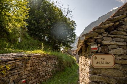
The paths are generally well marked (with signposts and red and white markings), but here and there it takes a sideways glance to recognise the trail markers. The condition of the paths is similar to mountain trails in Switzerland; some of them lead through lush vegetation that is cut back sporadically. The municipalities are responsible for trail maintenance, so BLS cannot provide any guarantees or accept liability. The trail has been restored thanks to support from the Sentieri Ossolani association.
This publication is co-financed by the European Union, the European Regional Development Fund, the Italian State, the Swiss Confederation and the cantons within the framework of the Interreg V-A Italy-Switzerland cooperation programme.
On the remaining stages of the ViaStockalper; Gondo–Iselle section with post bus:
Villages along the route
Iselle di Trasquera village
This small but famous border village is made up of two parts: the station section with the entrance to the Simplon Tunnel (tunnel length: 19,803 km) and a little further up the pass road the actual hamlet.
In September 1800 Napoleon ordered the construction of a large military road through the Simplon; the work took five years and produced the first high mountain road. In 1805 a postal service was established, and stagecoach transit began in 1808. An inn was built in Iselle for travellers and for changing horses. When work began on the Simplon Tunnel in 1888, Iselle was bustling with foreigners coming to marvel at the start of the colossal construction, as well as the workers who were working on it.
The village of Iselle played a starring role in the Italian-Swiss events commemorating the “Napoleonic” road and, in 2006, the centenary of the Simplon Tunnel.
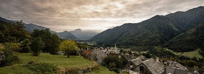
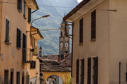
Varzo village
Many small villages in the Ossola Valley are crossings and connections between Italy and Switzerland. This is also true for Varzo in the Divedro Valley, on the state road that connects Domodossola with Switzerland’s Simplon Pass.
The name Varzo recalls the Celtic word “Vargo” and is thus symbolic of the passage that the place represents in the narrow gorge with almost vertical boulders.
A history of conquests and border disputes has characterised the small town of Varzo for centuries. Among the most interesting historical sites are the imposing granite tower near the town hall, the Archaeological Museum, St. George’s parish church, with its portal financed by Kaspar Stockalper, and the chapels along the Via Crucis.
The 53 hamlets dot the sunny plateaus in the municipality of Varzo. One of the best known is San Domenico, a popular destination in winter thanks to its super-modern ski facilities in the Ossola Valley ski area. But in the summer too, excursions, outdoor activities for young and old, and the typical cuisine from this corner of Piedmont on the border with Switzerland make it one of the most visited areas.
Preglia village
Preglia is one of the five main villages (Caddo, Preglia, Crevola, Oira and Pontemaglio) in the municipality of Crevoladossola. The villages were united by royal decree in 1928. The municipality extends from the borders of Domodossola towards the entrance to the Antigorio and Divedro valleys.
Preglia, or in ancient times Predelia, stretches between Caddo and Crevola and includes the train station and many new buildings; it has become the most populated part of Crevoladossola. The three-aisled parish church of Saints Stephen and Anthony the Abbot dates back to 1611; in 1755 it was united with the parish of Caddo.
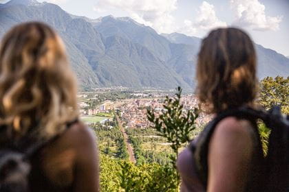
City of Domodossola
A thriving city at the foot of Monte Rosa
Domodossola is the centre of an entire region: Domus Ossulae, home of the Ossolans, is what the Romans called the town at the foot of the Alps. From the side valleys and down from the Alps, farmers flock to the market to offer their goods. Domodossola lies in the valley of the River Toce at only 270 metres above sea level, but is also at the foot of the 4,600-metre-high Monte Rosa massif. When the view opens up down the narrow streets, you can catch a glimpse of the massif and its high mountains.
The route out of the city at the foot of the hill is marked with sun symbols, and in quarter of an hour we find ourselves at the bottom of the Via Crucis. Birds chirp between fig and chestnut trees, while lizards scurry over the natural stone walls. Around almost every bend we come across a small chapel, until we eventually reach the two larger chapels dedicated to Jesus’ death and burial: With this pilgrimage route, the people aimed to reproduce Christ’s Way of the Cross. Work began back in 1656, and more and more buildings were subsequently added. Stockalper went into exile on Sacred Mount Calvary (1679-1685). These days, the Sacred Mount Calvary and the other eight “Sacri Monti” of northern Italy are a UNESCO World Heritage Site.
Historical background
Guided hike
Two-day trek
A wonderful hike that takes you through the sunny alpine pastures above Varzo on the first day. Overnight in the Rifugio Crosta mountain refuge, whose super-friendly managers Marina and Enrico know how to spoil their customers and offer them a pleasant environment. The second day is spent hiking over the Passo della Colmine to Foppiano, Mozzio and Crodo, where you can take the bus back to Domodossola in the afternoon. You can also opt to include Alpe Genuina here and extend the hike for 3 km.
Technical data
1st day: elevation gain and loss ascent ↑ 1,225 m, descent ↓ 0 m, length 6.5 km, purely walking time approx. 5 hours
2nd day: elevation gain and loss ascent ↑ 420 m, descent ↓ 1,600 m, length 13.5 km, purely walking time approx. 7 hours
Languages
German and Italian
Prices
- € 170 Half-day hike up to 4 hours (09.00 to 13.00)
- € 270 Full-day hike up to 8 hours (09.00 to 17.00)
Surcharge for each additional hour: € 25.00
Prices in EUR incl. VAT / Prices are subject to change without notice
Enquiries and bookings at: mayer.susanne@libero.it
Contact
- Susanne Mayer, Tourist Guide Official guide in the nature reserves Veglia, Devero und Antrona
- +39 349 4056235
- mayer.susanne@libero.it
- www.lagomaggiore-ossolaguide.com
BLS suggestion
- Market in Domodossola: Saturdays from 8.30 to 14.30.
- Officina del cioccolato a third-generation chocolatier: a lipstick, toolbox or artist’s palette made of chocolate – for the perfect souvenir.
- The Casa dei Ravioli is a traditional pasta producer in the centre of the city. It supplies restaurants with fresh pasta in more than 80 shapes, which is also available to buy directly in the factory shop.
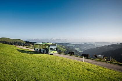
How to get there
You can reach the starting points Iselle di Trasquera, Varzo, Preglia and Domodossola comfortably with the RegioExpress operated by BLS.
- Timetable & tickets Iselle di Trasquera
- Timetable & tickets Varzo
- Timetable & tickets Preglia
- Timetable & tickets Domodossola
Saver Day Passes from CHF 29.00 (with Half Fare Card, 2nd class)
Travel for a whole day across Switzerland by public transport from just CHF 29.00 – whether by train, bus, or boat. The fastest pay the least: the earlier you buy, the lower the price.
Location
Contact
- BLS Ltd, Customer Service team
- +41 58 327 31 32 Daily 07.00–19.00