Age verification
Are you 18 years of age or older?
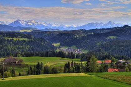
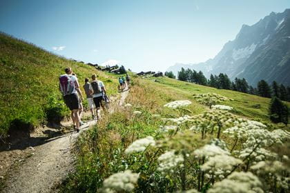
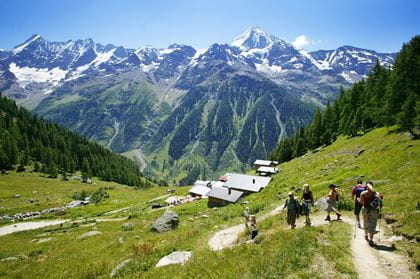
Fafleralp hiking paradise in Lötschental
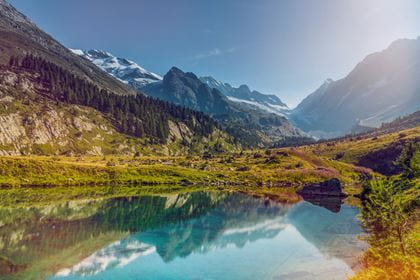
Impressive hikes to mountain lakes and glaciers
Fafleralp at the end of the Lötschental valley is the starting point for magnificent hikes. Be it a hike to the various mountain lakes or to the Lang Glacier or the start of the «Lötschental high trail» path.
Fafleralp in the most distant part of the Lötschental valley captivates with its impressive landscape. Mountain lakes with crystal-clear water, glaciers and a huge variety of flowers are characteristic images. In autumn, larches immerse the landscape in a golden light. Fafleralp is a genuine El Dorado for hikers.
You can reach Fafleralp from Bern in just over two hours by public transport. Travel directly from Bern to Goppenstein with the RegioExpress. Then take the post bus to Fafleralp.

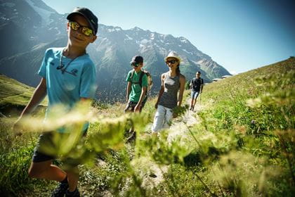
Legends Trail Fafleralp–Lauchernalp suitable for families
Thanks to the exciting legends quiz, the trail is an adventure for both old and young.
Solve the mystery along the various stations of the Legends Trail and receive a prize at the end of the trail. Suitable for children aged 5 and over.
| Hiking trail |
Fafleralp–Lauchernalp mountain station |
| Distance |
9.3 km |
| Duration | 2 hours 40 minutes |
| Elevation difference | + 132 m / - 335 m |
| Degree of difficulty | medium |
| Catering options |
|
| Sights along the way |
The idyllic, legendary Black Lake invites swimming in the summer. |
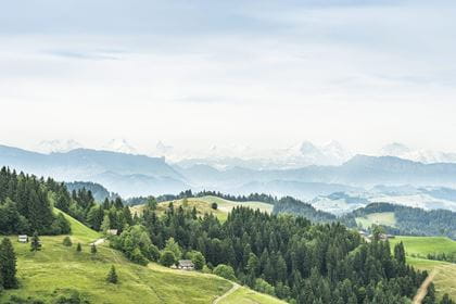
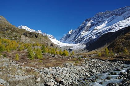
Lötschental high trail the classic

Circular hike Fafleralp–Anenhütte–Fafleralp
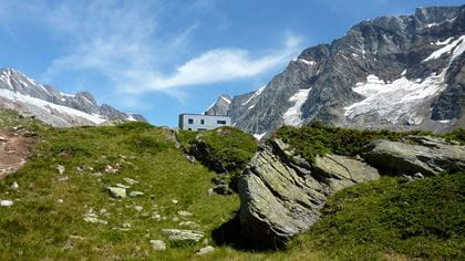
This nature trail themed around the climate and glacier landscape lies in the UNESCO world natural heritage site of the Swiss Alps Jungfrau-Aletsch. The hike takes you through the diverse vegetation zones of the glacier foreland and reveals a spectacular mountain landscape. There are few places in the Alps where a glacier foreland is as easy to access as at the Lang Glacier behind Fafleralp, which is recognised by UNESCO.
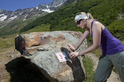
The nature trail does not feature the usual display boards but subtle numbered signs. Free flyers contain the information on the individual stations. A QR code is also available, alongside the numbered signs. Take a photograph of the code using the camera on your smartphone and a previously installed program will decode the information.
| Hiking trail | Fafleralp–Grundsee–Lang Glacier–Anenhütte–Guggisee–Fafleralp |
| Distance | 11.4 km |
| Duration | 4 hours 15 minutes |
| Elevation difference |
+ 633 m / - 633 m |
| Degree of difficulty |
medium |
| Catering options |
|
| Sights along the way | Guggisee, view across the Lötschental valley Lötschenlücke mountain pass Anenhütte |
| Points to note | The last section to the glacier gate is an Alpine hiking trail (blue and white markings) |
Operating times Today (Friday) open
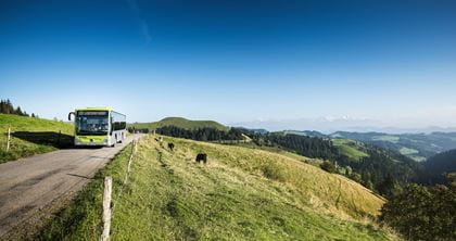
Post bus to Fafleralp
Daily, from 30 May to 11 November 2026
The post bus runs hourly with a connection in Goppenstein to the RegioExpress.
Operating hours Wiler–Lauchernalp aerial cableway
30 May to 5 June 2026 08.25–16.25 hours
6 June to 10 July 2026 08.25–18.25 hours
11 July to 16 August 2026 08.25–20.25 hours
17 August to 8 November 2026 08.25–18.25 hours
Subject to change without prior notice
How to get there
Travel in comfort by train to Goppenstein. From Goppenstein train station, the post bus (in the direction of Blatten/Fafleralp) will take you to the starting point at Fafleralp in around 30 minutes.


Location
Contact
- Lötschental Marketing AG
- +41 27 938 88 88
- Lötschental Marketing www.loetschental.ch