Age verification
Are you 18 years of age or older?
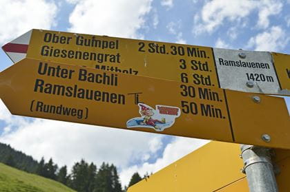
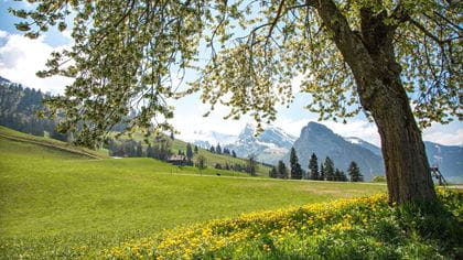
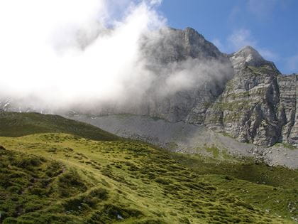
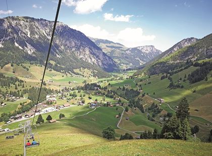
Hiking in the Diemtigtal Valley
The hiking options in the Diemtigtal Nature Park are plentiful and diverse. We’ve compiled the nicest routes for you here.
There’s a lot to discover in the Diemtigtal Nature Park. Here you can get active in the midst of breathtaking nature and fresh air whilst enjoying many interesting and amazing experiences. Simple mountain eateries invite you to fuel up along the way and spoil you with regional delicacies.
You can easily reach the starting points in the valley by train and post bus.
Go on a hiking tour, stop now and then, enjoy the view, the peace and nature. And in the evening you return home tired but satisfied.
Diemtigtal House Trails
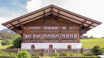
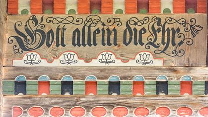
On the trail of traditional Simmental architecture
The Diemtigtal valley owes its impressive collection of buildings to wealthy farmers and skilled craftsmen. The splendid architecture is testament to the flourishing cattle trade and the success of horse-breeding and dates back as far as the 16th century. Each house has its own history and particular features. The Hausweg brochure (House trail brochure) and the Diemtigtal app are the ideal companions and provide you with all the important information along the way.
The architectural sights are spread along a route of more than 30 kilometres. Since this is too far for one single hike, they are divided into three circular routes, which you can comfortably hike in three to three and a half hours. Those who want to can travel the entire route by e-bike on quiet back roads.
Route 1
Front valley
| Walking route | Oey–Feld–Hasli–Sälbeze–Bächlen–Grund– Diemtigen Dorf–Bergli–Diemtigen Dorf–Oey |
| Distance | 9,1 km |
| Walking time | 3 h |
| Elevation difference | 437 m |
| Difficulty level | easy |
- Further information on route 1 of the Diemtigtaler Hausweg
- Timetable & tickets by train to Oey-Diemtigen
Route 2
Middle valley
| Hiking route | Horboden–Entschwil–Riedern–Rothbad–Walkenmatte–Rüti–Wattfluh–Horboden |
| Distance | 10,2 km |
| Walking time | 3 h 15 m |
| Elevation difference | 434 m |
| Difficulty level | easy |
- Further information on route 2 of the Diemtigtaler Hausweg
- Timetable & tickets by train and post bus to "Horboden, Chirel"
Route 3
Rear valley
| Hiking route | Zwischenflüh/Riedli–Oeyen–Boden–Houete–Schwenden/Tiermatti–Kapelle–Kuhrhaus–Schürmatte–Rain–Tiermatti |
| Distance | 11,2 km |
| Walking time | 3 h 15m |
| Elevation difference | 380 m |
| Difficulty level | easy |
- Further information on route 3 of the Diemtigtaler Hausweg
- Timetable & tickets by train and post bus to "Riedli, Talstation Wiriehorn"
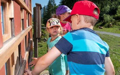
Theme trails
Hiking for the inquisitive
Would you like to discover exciting things about the culture and nature of the Diemtigtal valley whilst you are hiking? Then the following themed trails are perfect for you. Here you will find suggestions for short and easy circular hikes that are enlivened with comprehensible and interesting information, and which are also suitable for children.
Bird trail
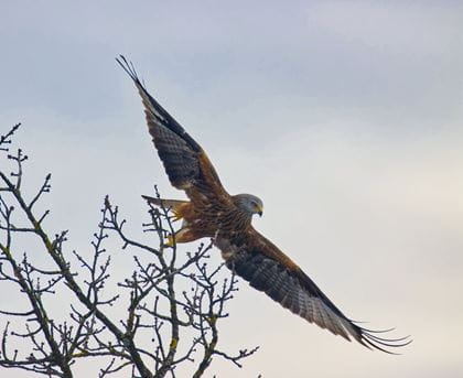
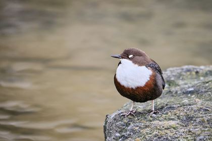
From Rotmilan to Wasseramsel
The bird trail takes you through numerous habitats for native bird species. Observe the nesting site of a pair of swifts using a nest camera or check your knowledge of bird calls. On this circular trail, you’ll learn lots of amazing facts about our birds.
| Hiking route | Marktplatz Oey–Grafestei–Zälg–Bächlen–Gruebi–Marktplatz Oey |
| Distance | 6,2 km |
| Walking time | 2 hours |
| Elevation difference | 220 m |
| Difficulty level | medium |
| Catering facilities | Ofehüsi im Gruebi Covered barbecue site (Katzenloch) |
- More information about the Bird Trail
- Timetable & tickets by train to Oey-Diemtigen
Albert Schweitzer Circular Trail
Virtual themed circular trail on Grimmialp
Albert Schweitzer spent his holidays at the Grimmialp spa resort no fewer than eight times. A walking trail with multiple benches and quotations by the famous holiday guest was created in his honour. Download the app on your smartphone before the walk and learn all about the rich life of the doctor, philosopher, theologian and organist. Along the virtual circuit you’ll be confronted with questions that will get you thinking about individualism, vocation, orientation, daring and destiny.
| Hiking route | Kurhaus Grimmialp–Blauseeli–Schwenden–Kurhaus Grimmialp |
| Distance | 4,8 km |
| Walking time | 1 hour 30 minutes |
| Elevation difference | 121 m |
| Difficulty level | easy |
| Catering facilities | Restaurant Eggli Restaurant Spillgerten |
- More information about the Albert Schweitzer Trail
- Timetable & tickets by train and post bus to "Schwenden, Winteregg"
Wrestling Trail Springenboden
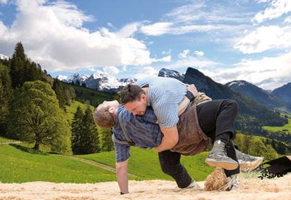
Insight into the world of Swiss wrestling: “The path to becoming king”
Did you know that three greats of Swiss wrestling came from the Diemtigtal Valley? On this circular trail around the home turf of Kilian Wenger, you’ll find out all about this popular and rustic national sport. The themed trail is currently being revised and will be integrated into the Diemtigtal app from 21 June 2026. Look forward to new interactive content for young and old alike!
| Hiking route | Haseloch–Springenboden–Haseloch |
| Distance | 2,5 km |
| Walking time | 1 hours 30 minutes |
| Elevation difference | 107 m |
| Difficulty level | easy |
| Catering facilities | Covered barbecue site Restaurant Gsässweid Restaurant Springenboden Gasthaus Rothbad |
- Horboden–Springenboden on-demand transport service: +41 79 616 90 45
- Timetable & tickets by train and post bus to "Horboden, Chirel"
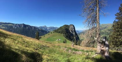
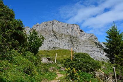
Wiriehorn Geology Trail
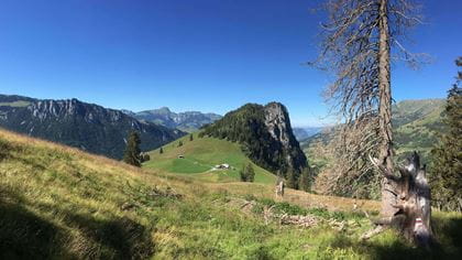
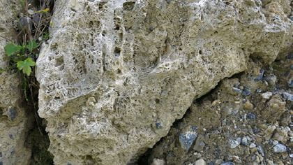
How a sea became a cultural landscape
The rock of the Wiriehorn was formed about 240 million years ago, in the time when dinosaurs still lived on our planet. The geological discovery trail is dedicated to the formation of this impressive landscape over millions of years. On the geological trail around the Wiriehorn, you’ll learn lots of interesting facts about mountain and valley, glacier and water, rock and stone.
| Hiking route | Bergstation Wiriehorn–Gurbs Mettelberg–Abendmatte–Tubelfärrich–Bergstation Wiriehorn |
| Distance | 9.2 km |
| Walking time | 3 hours 30 minutes |
| Elevation difference | 622 m |
| Difficulty level | medium |
| Catering facilities | Berghotel Wiriehorn Bergrestaurant Alp Schwarzenberg |
- More information about the Wiriehorn Geopath
- Timetable & tickets by train and post bus to "Riedli, Talstation Wiriehorn"
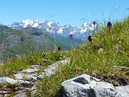
Kraftort Grimmiwasser Alpine meadow
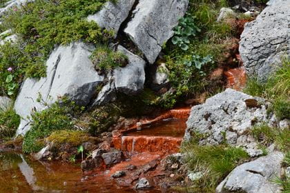
The healing springs of the Diemtigtal Valley
This hike impresses not only with its breathtaking high alpine landscape and rare alpine flowers. But above all, it is the red, ferruginous springs that make this place so special and have given it the reputation of a place of power. High up on Grimmialp, the spring bubbles out of the stony ground at the foot of a huge rock face with incredible clarity. The healing waters are said to have given countless sick people lasting healing and a new lease of life.
| Hiking route | Postautohaltestelle Schwenden i. D., Grimmialp-Senggiweid-Würzi-Alp Grimmi-Kraftort Grimmiwasser-Alp Nidegg–Postautohaltestelle Schwenden i. D., Grimmialp |
| Distance | 11,8 km |
| Walking time | 4 hours 15 minutes |
| Elevation difference | 621 m |
| Difficulty level | medium |
| Catering facilities | Bergrestaurant Grimmi |
- Further information on the Grimmiwasser mountain hike
- Timetable & tickets by train & post bus to "Schwenden i.D., Grimmialp".
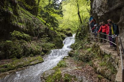
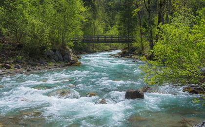
Valley hiking trail
Hike along the Fildrich and Chirel rivers
This valley hiking trail follows the Fildrich and Chirel rivers and takes you over 11 bridges, through shady forests, and across lush flower meadows. On hot days, it remains pleasantly cool along the riverbank and in the shade of the trees, so the trail is ideal even in high summer, too. Along the route, five barbecue sites invite you to take a rest and enjoy a picnic. The approximately 15-km-long hiking trail runs away from the road, but does lead to eleven Postbus stops at intervals of between 20 and 40 minutes. This offers you countless shortcut options and hiking variations.
| Hiking route | Sennggiweid (Grimmialp)–Schwenden–Grundwasser–Oey |
| Distance | 15 km |
| Walking time | 4 hours |
| Elevation difference | 140 m |
| Difficulty level | medium |
| Catering facilities | 5 Barbecue areas |
- Further information about the valley hiking trail
- Timetable & tickets by train and post bus to "Schwenden i. D., Grimmialp"
Availability Today (Tuesday) open
The hiking trails are accessible daily from April to November, depending on the weather and snow conditions.
How to get there
Location
Contact
- Naturpark Diemtigtal
- +41 33 552 26 00
- Naturpark Diemtigtal www.diemtigtal.ch