Via Alpine Panorama Trail to Lüderenalp
Hike from Emmenmatt through the Dürsrüttiwald forest, over Ober Rafrüti and up to the Lüderenalp
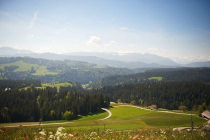
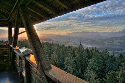
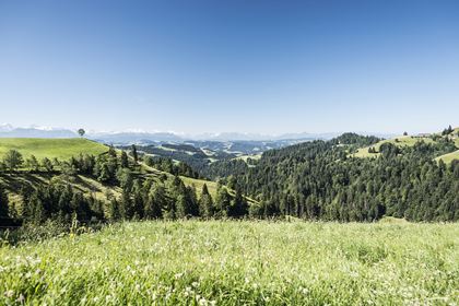
The start of the hike in Emmenmatt is at the confluence of the Ilfis and Emme rivers before the latter flows towards Burgdorf and finally into the Aare in Solothurn. The Dürsrüttiwald forest with its thick and tall silver firs is another special feature steeped in history. Unfortunately, the silver firs were felled illegally and now remain in the forest. On the way along the ridge and finally at the Ober Rafrüti vantage point and from the Lüderenalp restaurant terrace, you can enjoy the fantastic mountain panorama time and again.
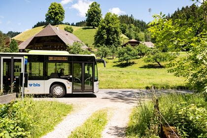
Travel in comfort with the BLS to "Emmenmatt".

Route description
From Emmenmatt, the trail leads along stage 15 of Swiss hiking route No. 3, the Alpine Panorama Trail, first over the Emme river and then immediately over the Ilfis towards the Lüderenalp. After a steeper ascent, the path continues over the long mountain ridges and through the Dürsrütiwald and Geissbühlwald forests. Again and again there are short, unwooded sections with views of the Central Plateau and the Alps. After Fluhhüsli there are two more ascents until you reach the Ober Rafrüti viewpoint. After a short forest section, Lüderenalp is now in sight and can be reached in a few minutes. Enjoy the magnificent view of the Alps once again, along with some delicious food, on the restaurant’s terrace.
Key information
| Hiking route | Emmenmatt-Dürsrütiwald-Ober Rafrüti-Lüderenalp |
| Distance | 11.8 km |
| Hiking time | 3 hours 50 minutes |
| Elevation difference | ascent: 762 m / descent: 272 m |
| Degree of difficulty | medium |
Incidentally, the entire Alpine Panorama Trail covers 510 kilometres with 30 stages, taking you from Lake Constance right across Switzerland to Lake Geneva.
Availability & arrival Today (Saturday) open
4 May to 27 October 2024, every Saturday, Sunday and on general public holidays
Travel by rail to “Emmenmatt”.
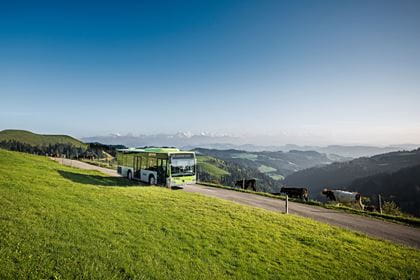
For your return journey from “Lüderenalp”, take bus line 285.
Normal public transport fares apply to the BLS hiking bus.
Food & Drink
Enjoy a break from your hike in the restaurants between Eriswil and the Lüderenalp.
- ATTENTION: The Restaurant Muser is no longer in operation
- Restaurant Bärnsicht Lüderenalp