Hiking on the Stockhorn
Discover the diverse hiking options and walking trails in the Stockhorn area.
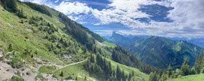
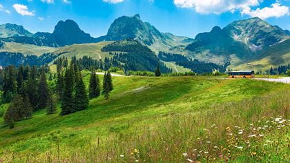
The well-maintained hiking trails around the Stockhorn offer ideal hiking options for all levels of ability. For those with a thirst for knowledge, we recommend the Adventure Trail and Alpine Flower Trail, for families the Quiz Trail, and for the more experienced the high-altitude hike from Gurnigel to the Stockhorn.
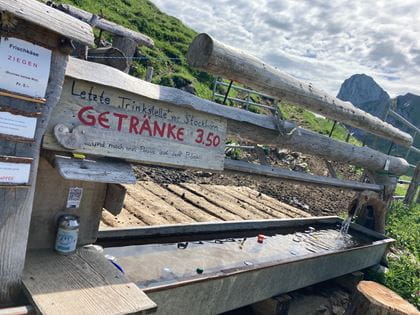
Travel by public transport and benefit from the discount that comes with the “Gurnigel-Stockhorn hiking ticket”.
Hiking routes
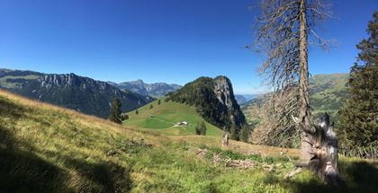
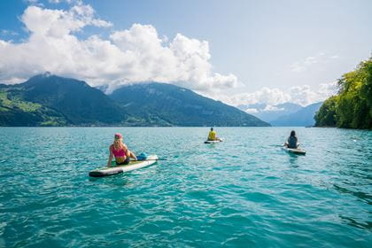
Explore the Stockhorn area on a hike or a leisurely walk and enjoy breathtaking views. Instead of taking the train back down to the valley, why not rent scooter bikes from Vorderstockenalp?
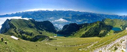
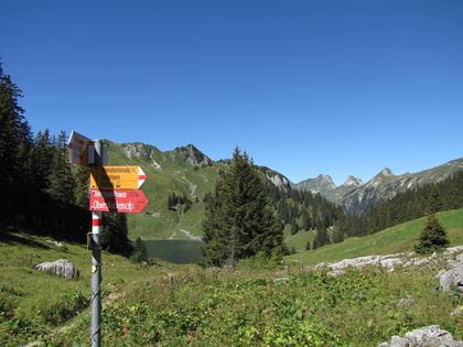
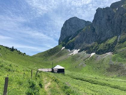
Stockhorn–Stockenfeld–Oberstockenalp
The classic
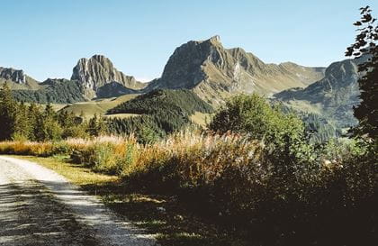
This classic offers breathtaking views from Lake Thun to the Jura.
Key data
| Route | Bergstation Stockhornbahn–Stockenfeld–Oberstockenalp–Mittelstation Chrindi |
| Walking time |
1 h 10 min. ascent/ 40 min. descent |
| Level of difficulty | medium |
| Heigh difference |
+ 61 m / – 568 m |
More details about the hike
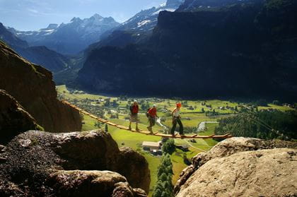
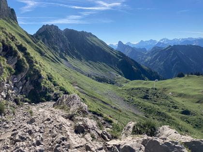
Stockhorn–Strüssligrat–Oberstockenalp
For those with a head for heights
This route offers an interesting alternative for sure-footed hikers with a head for heights.
Key data
| Route | Bergstation Stockhornbahn–Strüssligrat–Oberstockenalp |
| Walking time |
1 h 10 min. ascent / 50 min. descent |
| Level of difficulty | difficult |
| Heigh difference |
+ 105 m / – 612 m |
More details about the hike
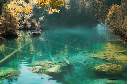
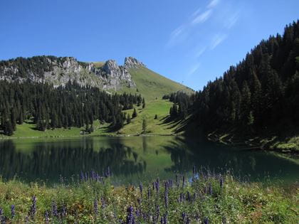
Oberstockenalp–Hinterstockensee–Chrindi
Leisurely hike
A leisurely hike through the forest down to the Hinterstockensee lake.
Key data
| Route | Oberstockenalp–Hinterstockensee–Mittelstation Chrindi |
| Walking time |
50 min. ascent / 40 min. descent |
| Level of difficulty | medium |
| Height difference |
– 358 hm / +52 hm |
More details about the hike
Stockhorn–Chummli–Oberbärgli–Chrindi
A route off the beaten track
A less-frequented trail with spectacular views.
Key data
| Route | Bergstation Stockhornbahn–Chummli–Oberbärgli–Mittelstation Chrindi |
| Walking time |
1 h 30 min. ascent / 1 h 10 min. descent |
| Level of difficulty | medium |
| Heigh difference |
+ 38 m / – 542 m |
More details about the hike
Chrindi–Chlusi–Erlenbach
Direct descent into the village
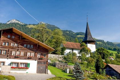
This route leads from the Chrindi middle station down to the village of Erlenbach i.S.
Key data
| Route | Mittelstation Chrindi–Chlusi–Erlenbach i.S. |
| Walking time |
3 h ascent / 2 h descent |
| Level of difficulty | medium |
| Height difference |
+ 4 m / – 921 m |
More details about the hike
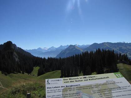
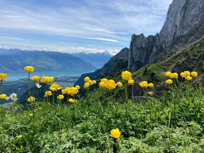
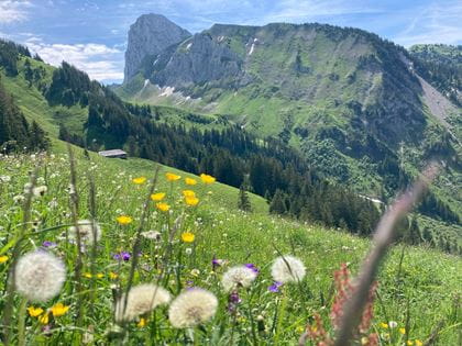
Alpine flowers nature trail
Discover the alpine flora in the Stockhorn area. Around 95 yellow name plaques can be found along the summit trail.
Key data
| Route | Bergstation Stockhornbahn–Stockhorngipfel |
| Walking time |
7 min |
| Level of difficulty | easy |
| Height difference |
+/– 50 m |
More details about the hike
Adventure Trail
Discover habitats
Inhale the scents, hear the bird calls, and read the tales – on the Adventure Trail you will discover the habitats on the Stockhorn.
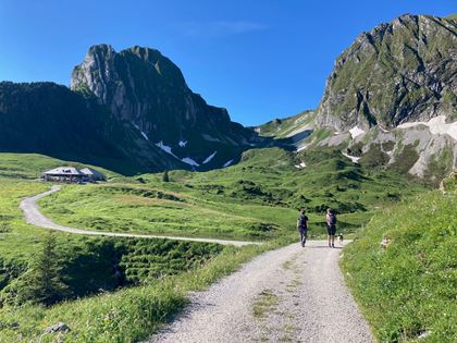
The Adventure Trail consists of 16 stations along the circular route around the two Stockensee lakes. Independent exploration and experience, enjoyment and pleasure are the main focus here. The path takes you from the middle station at Chrindi along well-maintained hiking paths to Oberstockenalp, the Oberstocken Lake and back via Vorderstockenalp to the starting point of Chrindi.
Key data
| Route | Mittelstation Chrindi–Oberstockensee–Chrindi |
| Walking Time |
2 h 45 min. |
A 70-page accompanying brochure produced by the University of Bern offers you background information on the individual topics. This and an overview map are available free of charge at the Stockhornbahn cable car.
More details about the hike
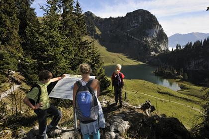
No Limits
Barrier-free circular route
The “No Limits” hiking trail that leads around the Hinterstockensee lake was designed to be accessible for wheelchairs and pushchairs. This way, people with restricted mobility can likewise enjoy the landscape unhindered. Four electrically powered, all-terrain “Mountain Drive” wheelchairs can be rented at the Chrindi middle station. Reservation recommended.
Key data
| Route | Mittelstation Chrindi–Hinterstockensee–Mittelstation Chrindi |
| Walking time |
40 min |
| Level of difficulty | easy |
| Height difference |
+/– 85 m |
More details about the hike
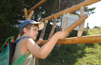
Quiz-Trail
Family-Tip
Enjoy a playful hike with kids while solving the puzzle. Along the lake circuit trail there are ten posts containing hidden letters, which form a word to solve the puzzle at the end of the Quiz Trail. As with all treasure hunts, there are plenty of adventures to be had along the way. This varied trail awakens all the senses, as well as children’s natural curiosity. They can climb, play and dawdle as they go.
Key data
| Route | Mittelstation Chrindi–Hinterstockensee–Mittelstation Chrindi |
| Walking time |
40 min |
| Level of difficulty |
easy |
| Height difference |
+/– 85 m |
More details about the hike
BLS suggestion High-altitude hike Gantrisch–Stockhorn
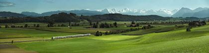
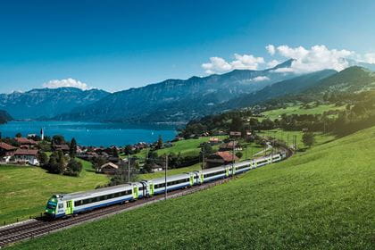
Do you know about the hiking ticket yet? Experience the classic high-altitude trail from Gurnigel to the Stockhorn at a special price. You travel with BLS to Thurnen and from there by post bus to Gurnigel Wasserscheide. Along the way, you’ll enjoy magnificent views of the Bernese Alps, Lake Thun and the Simmental valley. At the end of the hike, travel by cable car to Erlenbach in the Simmental and from there by train back home. The ticket is available exclusively in the BLS webshop.
Availability Today (Friday) open
Stockhornbahn operating information
13 April to 24 November 2024
Daily, every 30 minutes from 07.50 a.m. to 04.50 p.m.
Last descent from Stockhorn 5.35 p.m., from Chrindi 5.50 p.m.
Subject to change without prior notice
How to get there
Location & contact
Contact
- Stockhornbahn AG
- +41 33 681 21 81
- Stockhornbahn www.stockhorn.ch