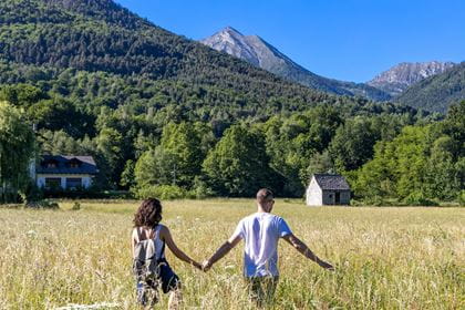
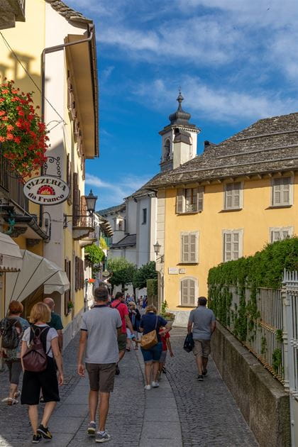
Hiking in Piedmont
Located in the north-west of Italy, Piedmont is surrounded on three sides by the Alps. The name means "at the foot of the mountain". So it's no wonder that there are some wonderful hiking trails in this area.
If you want to get away from the hustle and bustle of everyday life and experience the beauty of nature in its purest form, then you've come to the right place. No matter which of the hikes you choose, the mountain landscape and charming villages will delight you.
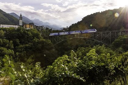
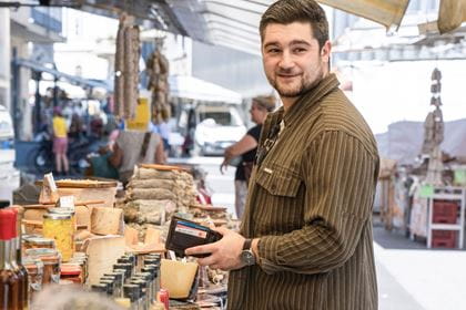
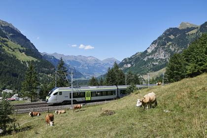
Nature lovers and hiking enthusiasts can travel quickly and comfortably on the BLS RegioExpress service Bern–Spiez–Kandersteg–Brig–Domodossola to this region, which is also famous for its exquisite cuisine and excellent wines.
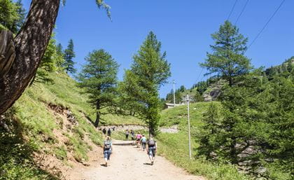
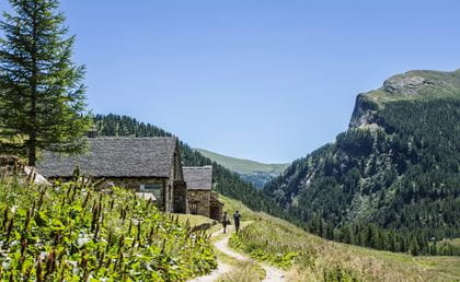
Valle Cairasca – from Varzo to San Domenico
A panoramic hike through alpine landscapes and fairytale forests
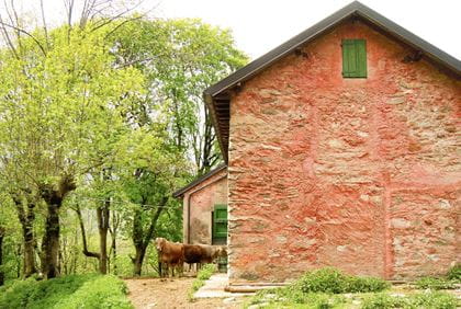
This beautiful hike through the Cairasca Valley leads across low mountain pastures and Alpine meadows from Varzo to San Domenico. The trail, which was included in the "Alps without borders" map series, also connects Veglia, Devero and Formazza with Airolo in the canton of Ticino (CH).
The route begins in the historic centre of Varzo. Take the lovely mule track, which follows the true left bank of the stream that criss-crosses Varzo to reach the hamlet of Colla. From here, you continue towards the castle and then follow the path upwards to Coggia and Alpe Nava. From here, you should follow the signs for the “Sentiero Naturalistico” (nature trail), which passes through a long series of Varzo’s Alpine meadows until it reaches first the Bosco delle Fate (Fairytale Forest) and then San Domenico.
Key data
| Hiking route | Varzo–Colla–Coggia–Alpe Nava–Plé –Loi–Torba–Fernone–Bosco delle Fate–San Domenico |
| Distance | 9.5 km |
| Elevation difference | Ascent: 912 m / Descent: 68 m |
| Duration | 3 hours 45 minutes |
| Level of difficulty | medium |
| Availability | The hiking trail is accessible all year round |
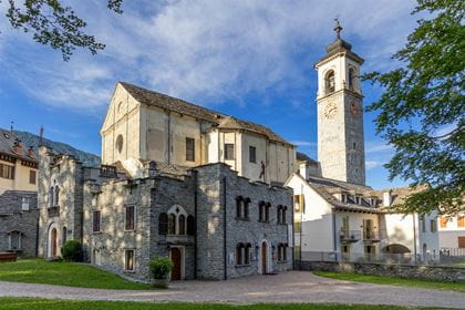
Archaeological Museum of Varzo
Visit the Archaeological Museum in Varzo before the hike. It offers a small, multimedia exhibition about the early history of the valleys, in particular about the Mesolithic hunters who came to the Veglia valley 8,000 years ago.
How to get there
The BLS RegioExpress service Bern–Spiez–Kandersteg–Brig–Domodossola takes you directly from Bern to Varzo. Your hike through the Valle Cairasca to San Domenico, paese starts there. The return journey is by bus to Varzo and then by train back to your starting point.
Recommended timetable
Arrival
| Berne from | 07.39 |
| Varzo to | 09.41 |
Return journey |
|
| * San Domenico, paese Mon-Fri from | 17.30 |
| * Varzo to | 17.50 |
| Varzo from | 18.08 |
| Brig to | 18.33 |
| Brig from | 18.48 |
| Berne to | 19.54 |
* On-call bus: Prontobus must be booked the day before by calling +39 339 4045429. Timetable valid until 9 June 2024.

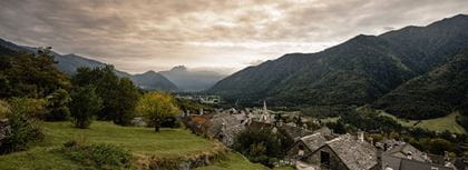
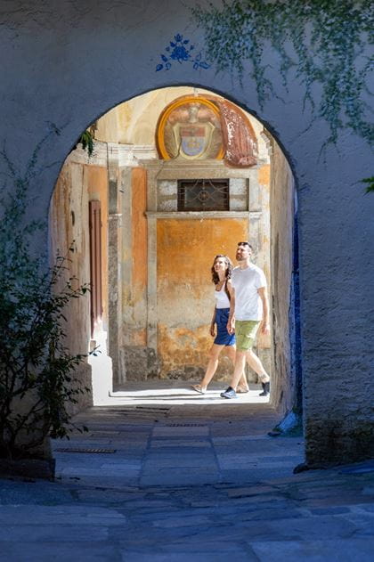
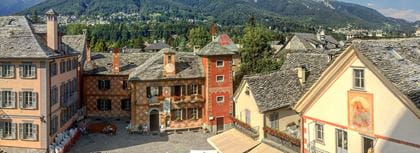
Valle Vigezzo – Known as the Valley of the Painters
Discover art from the past on the "Circuito dei Santi" in the form of richly decorated façades, chapels and places of worship.
From Domodossola, take the Centovalli railway to the historic Vigezzo Valley, which has been a great inspiration to many artists of the past thanks to its beauty. Quite a few of these artists left their mark decorating the facades of homes and churches with ornate murals that are still preserved today, which is why the valley is also often known as the “Valley of the Painters”. Follow in the footsteps of the great painters and artists of the 17th century. The hiking trail shows the artistic and historical wealth of that time and takes you to the valley's large churches and small oratories, where both Vigezzo artists and important foreign artists worked.
The "Circuito dei Santi" is an extensive network of hiking trails that stretches across the entire valley and connects the sacred monuments. Information boards can be found at the religious buildings along the entire route. There you will receive information on religion, art and history in the Vigezzo Valley. Particularly worthwhile is a visit to the main town of Santa Maria Maggiore and the connecting trail through pine forests to Druogno.
The "Circuito dei Santi" runs along three different routes. The western trail leads from Santa Maria Maggiore to Druogno. This hiking route takes approx. 1 hour and 15 minutes. From Druogno, the Centovalli railway takes you back to Domodossola.
The hiking trail is accessible all year round.
The sights of Santa Maria Maggiore
Large Market
A large market is held every Monday in Santa Maria Maggiore. It is about a 10-minute walk from Santa Maria Maggiore railway station.
Chimney Sweep Museum
Established in 1983, the museum tells of the customs and traditional occupations of the Vigezzo Valley.
House of Perfume
This small but fine mountain museum aims to recount the little-known origins of the famous Eau de Cologne.
Praudina Adventure Park
This rope park in the pine forest near Santa Maria Maggiore offers fun for all the family.
How to get there
Travel in comfort with the BLS RegioExpress service to Domodossola. Start with a trip on the Vigezzina-Centovalli railway from Domodossola to Santa Maria Maggiore. From there, set off on the footpath through the lush pine forest as far as Druogno. From Druogno, the circular route loops back to Domodossola.
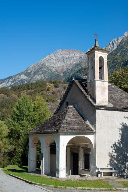
Via della Fede: Varzo–Trasquera
Via della Fede (Path of Faith): Varzo–Trasquera
The route initially follows small village streets within Varzo before taking the Veia di Brocc, a beautiful cobbled mule track that leads from Ponte Boldrini via Bertonio to Trasquera church. Because of the many chapels along the way, this route was once known as a path for meditation. Until 1961, when the navigable road was constructed, this was the main way of accessing Trasquera.
From the square by Varzo Railway Station, take the street leading to the right. Cross the old trunk road and continue straight ahead towards the centre of Varzo along Viale Castelli as far as the beautiful parish church of San Giorgio and the medieval tower.
In front of the tourist office, recross the stream and ascend Via Zanalda to the pretty oratory of San Rocco in the Alneda district. Continue on a level gradient along the main road (Via Alneda) between fine stone houses until you cross the main road leading to San Domenico.
On the left-hand side, there is a beautiful building with a tower. This is the base for the administrative authority responsible for the protected areas of the Ossola region. Here, you can ask for information about the Veglia Devero Park and visit the recently built “Archeomuseo” multimedia archaeology museum. Follow the level Via Galtarossa for its full length to reach Bertonio, where you will find the former Simplon trunk road at the Antica Osteria. Remaining on the pavement for a short time, follow the main road to the Ponte Boldrini Bridge, which crosses the Cairasca Valley.
The (signposted) mule track begins immediately after the bridge on the right-hand side. This mule track, Vèia d’Brocc, was the principal means of reaching Trasquera before the road was built in 1961. You continue ascending for some time via a number of sharp bends between beech and chestnut trees, using the resting places of the Cappella del Pianzolo and the Cappella del Sasso along the route.
In this way, you tackle the 500-metre ascent that brings you to the Trasquera parish church, dedicated to Saint Gervasio and Saint Protasio and situated in an evocative location on a cliff with views over the valley floor. Continue on the main road (Via Alpi Lepontine) to the centre of the village.
Key data
| Hiking route | Varzo Railway Station–Via Galtarossa–Fontana district–Bertonio district–Ponte Boldrini–Trasquera church–Trasquera village square |
| Elevation difference |
546 m uphill, 10 m downhill |
| Distance | 5,7 km |
| Duration | 2 hours 10 minutes |
| Level of difficulty |
medium difficulty |
| Availability | The hiking trail is accessible all year round |
How to get there
The trail is accessed with a return rail ticket to Iselle di Trasquera.
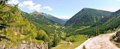
"Giro di Agro" circular trail
A very panoramic circular route that follows the line of the ridge separating the Divedro Valley from the Cairasca Valley.
From the town hall square, follow the signs to Agro Fuori and you will soon arrive at a well-marked crossroads. This leads you into the lovely Fraccia pine forest, where there is a fine farm building. At the signposted junction (path F38), take the side track towards Agro. This soon becomes a narrow path that begins to re-ascend the steep forested slope. The significant difference in height is tackled with the aid of hefty steps carved into the rock and sections equipped with safety barriers.
After this steep part of the walk, you reach the plateau on which the huts of the Alpe Agro Fuori are located, offering a sweeping view over the triptych of the Simplon mountains. First, the route continues further along the slope before descending towards the Alpe Agro Dentro (path F40). The Alpine meadow marks the start of a steep and quite challenging descent, which finishes on the Trasquera - Bugliaga road near the Ponte del Diavolo (Devil’s Bridge), constructed in 1880. The bridge is approximately 100 metres high with a 33.3-metre span.
Key data
| Hiking route | Trasquera–La Sotta–Agro Fuori–Agro Dentro–Schiaffo– Trasquera |
| Distance | 8,4 km |
| Elevation difference | 700 m |
| Duration | 3 hours 40 minutes |
| Lefel of difficulty | Route of medium difficulty, in places very steep |
| Paths | F38 + F40 + F40 + F00 |
| Availability | The hiking trail is accessible all year round |
How to get there
The trail is accessed with a return rail ticket to Iselle di Trasquera.
Domodossola–Preglia winter hike
Historical winter hike in northern Italy
The route from Domodossola to Preglia passes numerous historical locations, such as the Tower of Ardignaga, and heads through the typical northern Italian villages of Caddo, Monte, Canei and Bosco. Between the wooded and open areas, the view widens to encompass the plain of Domodossola, right across to the snowy peaks in the background. In winter especially, when the trees are bare, this hike across the sunny, terraced landscape is extremely rewarding and so characteristically Italian.
Part of one of the roads that historically connected central Europe with the Po Valley, the Via Francisca Ossolana, passes close to Domodossola. This first part, from Domodossola to Crevoladossola, does not follow the actual road, but passes instead through ancient settlements. The route initially encounters the sunny, scenically located villages of Crevola di Bosco, Canei and Monte. It then heads downhill, past the Tower of Ardignaga, to Mocogna, where it crosses the Bogna stream before the old dams come into view.
The trail to Caddo in Ardignaga is clearly sign-posted, and from there the trail begins to climb, with high stone walls marking the path. After crossing an area of woodland, where small cultivated fields supported by terraces are still well preserved, you are greeted by a beautiful panoramic view of the plain, from which the medieval Tower of Ardignaga rises. This is one of the most beautiful and majestic signal towers that are scattered across the Ossola region, whose existence is documented as far back as the 17th century.
Key data
| Hiking route | Domodossola–Mocogna–Preglia |
| Distance | 7.27 km |
| Elevation difference | 575 m |
| Duration | 2 hours 30 minutes |
| Level of difficulty | T2 |
| Viewpoints | Ardignaga Turm, Canei |
| Availability | The trail is available all year round, but is particularly recommended in the winter months (from November to March) as the entire trail is very exposed to the sun. |
BLS suggestion
How to get there
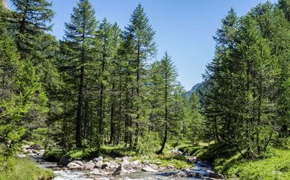
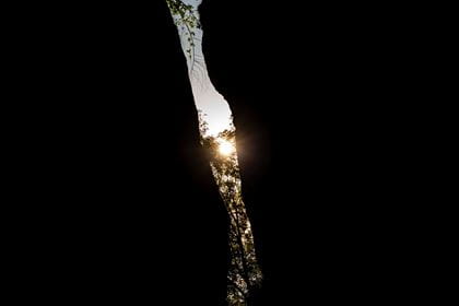
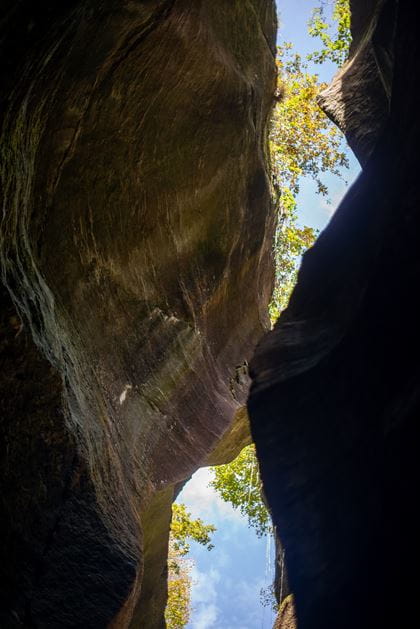
The Uriezzo Gorges
Incredible – the power of water when it is allowed to flood, bubble and gurgle for thousands of years
The Uriezzo gorges are located in the heart of the Valle Antigorio and tell the story of thousands of years of erosion by ancient glaciers.
During the last ice age around 12,000 years ago, the flowing waters eroded the rock here and left behind ludicrous formations: Glacial potholes, cauldrons, mills, grooves and niches. Some places are only a few metres wide, others up to 30 metres deep – a visit to the Uriezzo gorges is like a journey to the centre of the earth.
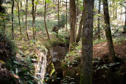
There are three gorges that have dried out and can therefore be walked through completely. The south gorge is the most spectacular. It is approx. 200 metres long and up to 30 metres deep.
The hiking trail is well developed and signposted. The differences in height can be overcome easily using iron steps. The rocky ground is covered in a layer of dried mud and can be muddy and slippery in wet weather. A complex ecosystem awaits you, characterised by high humidity, minimal light, and smooth, polished walls. Plants thrive here that are rarely found anywhere else. Mosses and ferns in particular have adapted perfectly to the difficult conditions.
Key data
| Starting point | Baceno |
| Distance | 6.5 km |
| Elevation difference | 200 m |
| Duration | 2 hours |
| Level of difficulty | easy |
| Availability | accessible from March to November |
How to get here
- Timetable & tickets to Domodossola
- Timetable Domodossola–Baceno valid until 9 June 2024; ticket sales on the bus

Location
Contact
- VisitOssola
- Visit Ossola www.visitossola.it